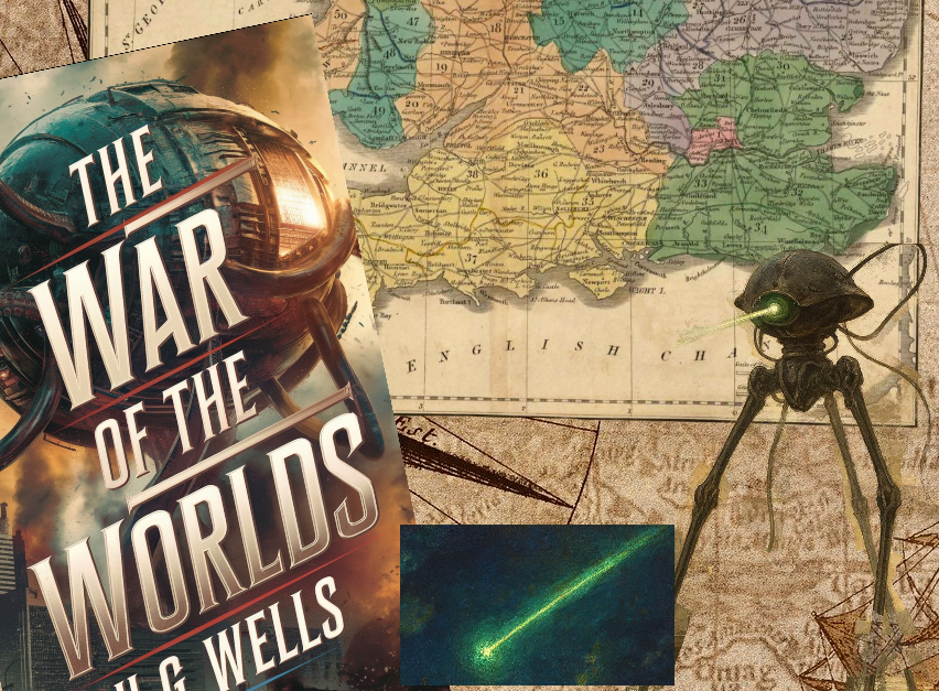
Many people across the world enjoy reading The War of the Worlds by H.G. Wells, the review on this site is one of the most popular posts we have, but not everyone can picture the geography. So, this page aims to help readers follow the Martians moving towards London.
To create this map I have used the mapping tool Felt. The images are taken from this Geographic Information System, but you can go to their site and interact with the map. Just click here to explore the Full Battle Map.

Unsurprisingly, there are spoilers on this page. The pictures on the post are created by prompts I have given Microsoft Copilot.
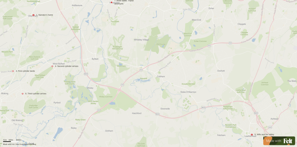
1. Ottershaw
Ottershaw is a village in the Borough of Runnymede in Surrey. It is just north of Woking, which makes it an ideal location for the narrator’s home.
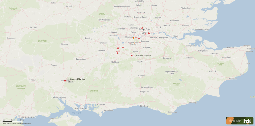
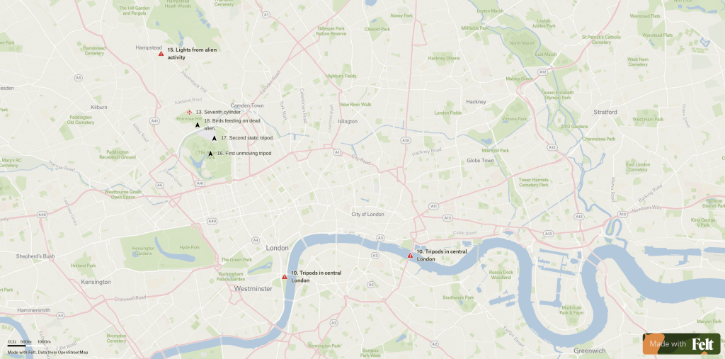
2. Winchester
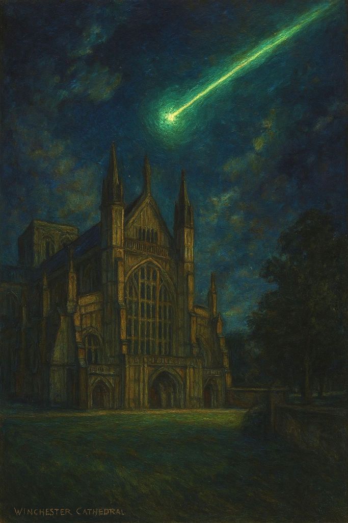
Winchester is a cathedral city in Hampshire and is located to the southwest of Woking. As a busy hub, it is the place where the first greenish of a shooting star is spotted.
3. Horsell Common
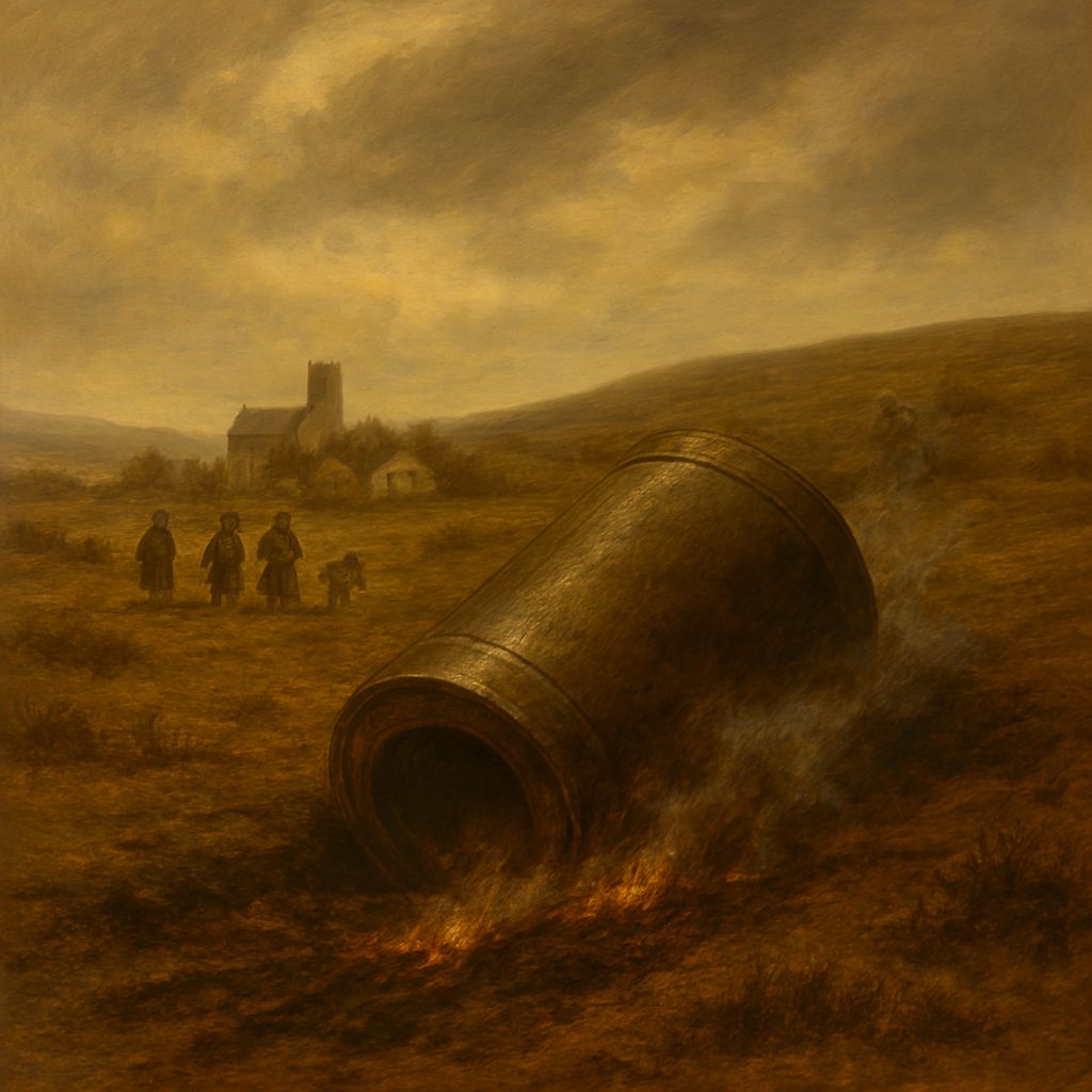
Sitting in North Woking, this is the area where the first Martian cylinder falls. The sandpit mentioned in the book is marked on Google Maps alongside alien-relevant reviews.
4. Byfleet Golf Links
Not far from the first crash site, a second cylinder arrives on Saturday night.
5. Leatherhead
To the east of Woking sits the town of Leatherhead. Our narrator, with family there, uses this as a safe location to keep his wife and servant safe.
6. Maybury Hill
Not far from the locations of the two cylinders, a third arrival from Mars crashed down. This is also the first time we hear about the famous Martian tripods. These vehicles send a clear message to the narrator that the aliens are not as helpless as humankind first thought.
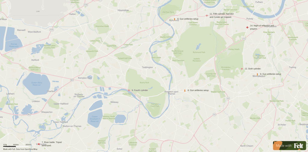
7. Weybridge
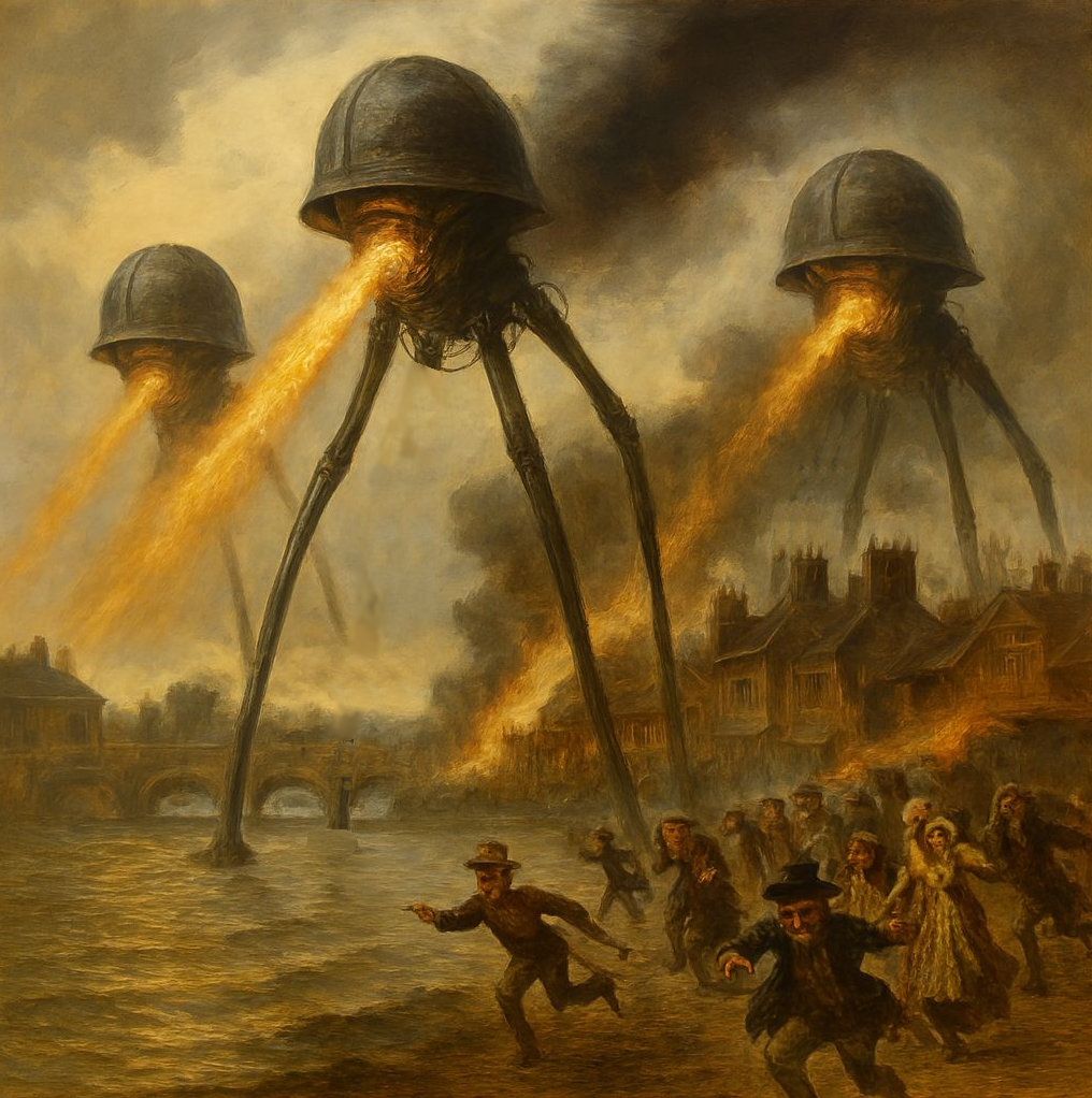
As the battle begins to move towards London, we arrive at Weybridge, near Shepperton Lock. As five tripods attack the escaping crowds trying to cross the River Thames, it becomes clear just how easily the Martians can conquer us. Although there is a glimmer of hope as one tripod is downed.
8. Kingston, Richmond & Wimbledon
Large guns were set up in the hope of defeating the invaders. The Martians have learnt from the previous battles and use a new weapon against humankind. A black, poisonous vapour is shot into these areas using large tubes held by the tripods.
9. Bushey Park
Another brilliant green meteor is seen in the sky as the fourth cylinder crashed down near the south-west London park.
10. Pool of London
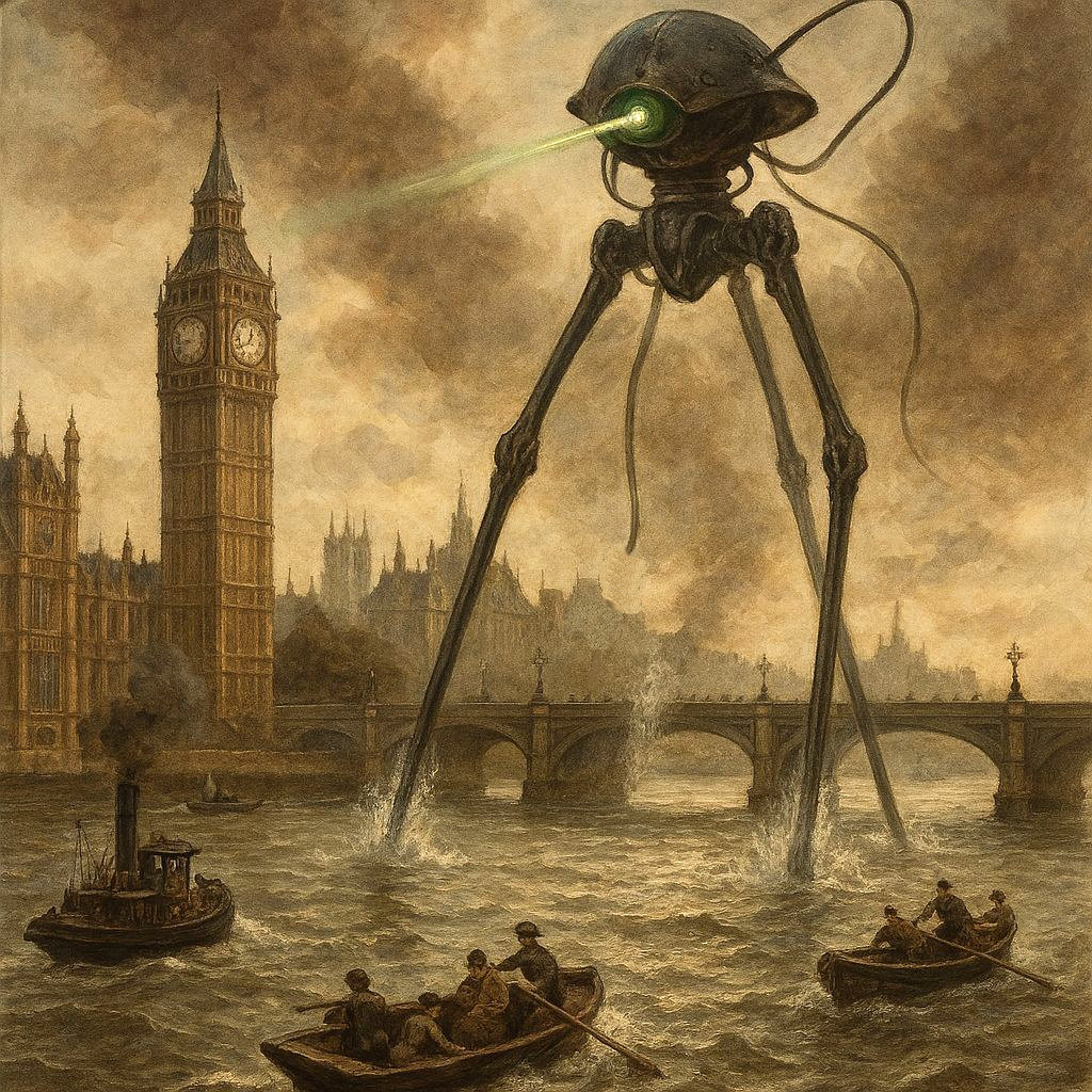
The Pool of London is just downriver of Tower Bridge, but this activity marks the arrival of the Martians in central London. As boats try to escape down the River Thames, a tripod is seen overshadowing the UK parliament, the Palace of Westminster.
11. Mortlake
This small suburb in southwest London is the crash site of the fifth cylinder and the location where the narrator and Curate get trapped. It is here that we discover how the aliens plan to use the people of Earth.
12. Wimbledon
The crash area for the sixth cylinder.
13. Primrose Hill
The crash area for the seventh cylinder.
14. Putney Hill
A night of reflection and prayers for our narrator.
15. Hampstead
Even though Hampstead is located in North London, the lights from alien activity there can be seen by the narrator from across the Thames in South London.
16. Regent’s Park
The first unmoving tripod that the narrator sees. Although why it remains still is a mystery at this time.
17. London Zoo
Across Regent’s Park in London Zoo, the narrator finds a second static tripod.
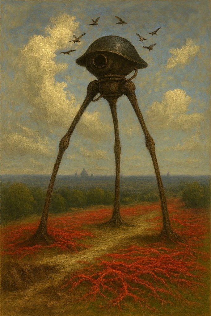
18. Primrose Hill
Primrose Hill overlooks London and is an amazing location for people to see the capital. It is here that the third dead alien is seen by the narrator. This one has birds feeding on the Martian’s dead body and is surrounded by the dying red weed.

Leave a reply to The War of the Worlds – Ravens Watch Cancel reply